Regular Office Hours 8 am to 4 pm Monday to Friday


Maps
Historic and Rehabilitation Area Maps
View the Schooley's Mountain Area Map (pdf)
View the German Valley Area Map (pdf)
View the Middle Valley Area Map (pdf)
Township Tax Maps
View the Tax Maps (pdf)
Township Street Map
View the Street Map (pdf)
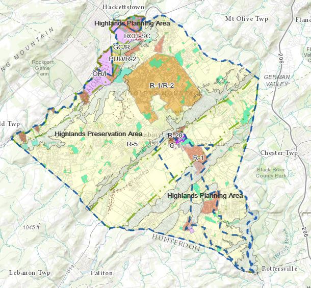
Township Zoning Map
View the Zoning Map (pdf)
Interactive GIS Map
View for Property Information. Map Options include Zoning and Land Use data.
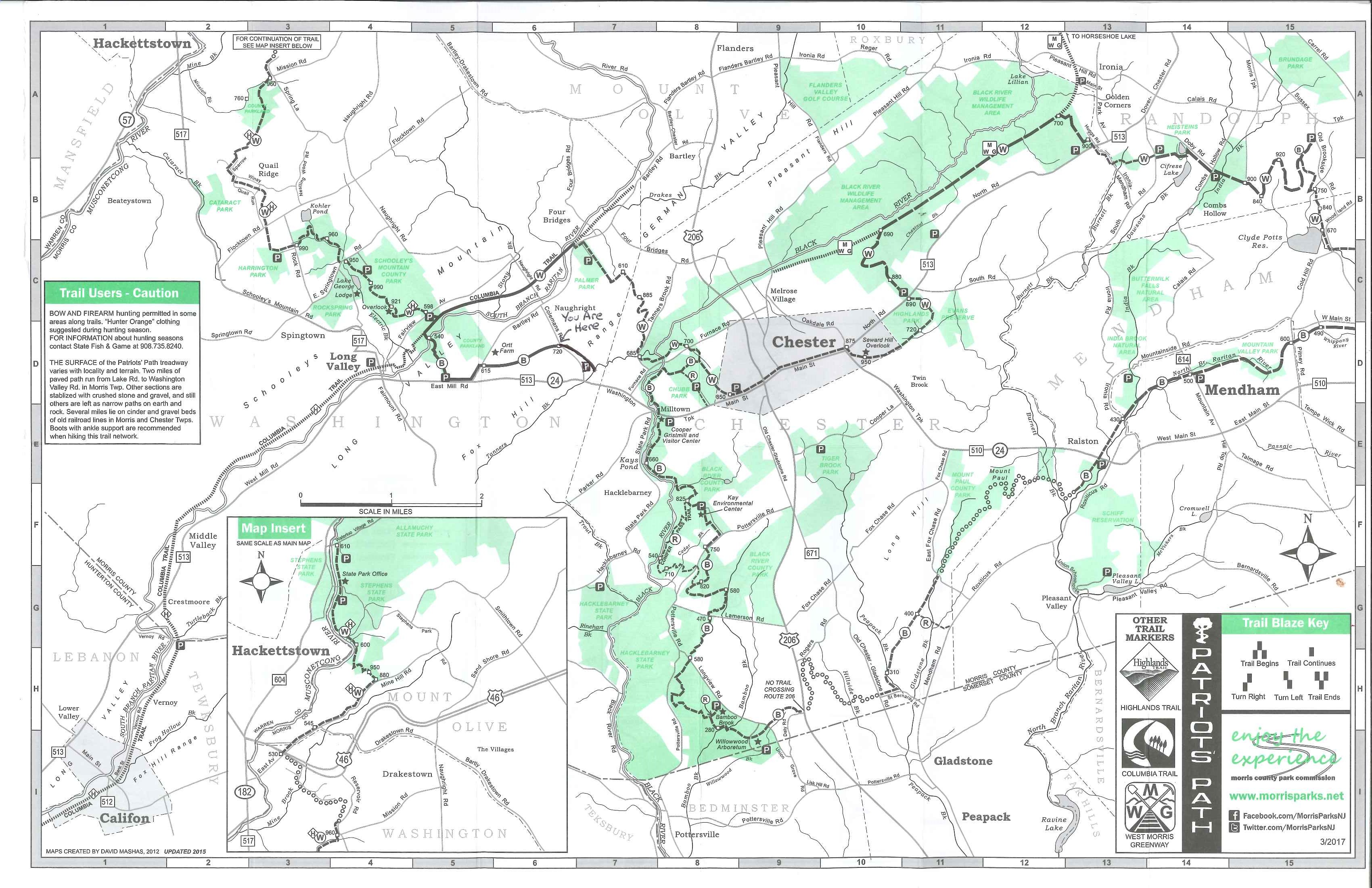
Trails Map
View the Trails Map.
Patriot's Path
FEMA Flood Maps
To view the Morris County Preliminary FIRM, visit: http://arcg.is/2zDVFcK
Additional information on mapping is available on FEMA’s Flood Map Service Center at https://msc.fema.gov/portal, and flood insurance information can be found at https://www.fema.gov/national-flood-insurance-program.
The Morris County Office of Planning and Preservation also has information on the FEMA FIRM and other flood related topics on their website: https://planning.morriscountynj.gov/firm
Township Voting District Map
View the Voting Districts